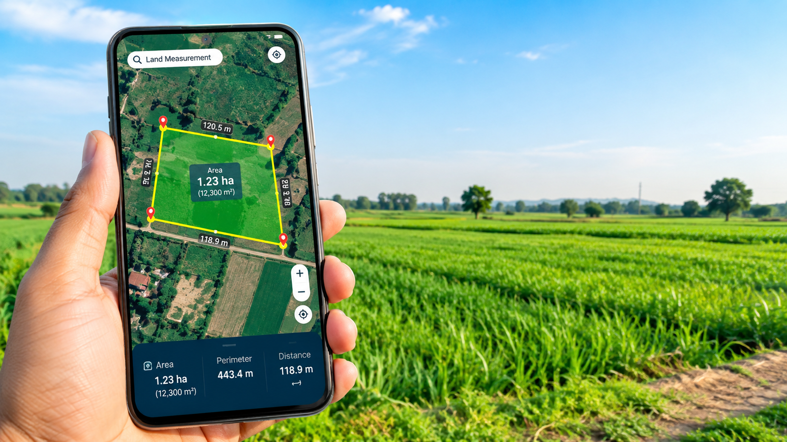
आज के समय में smartphone सिर्फ calling और internet browsing तक सीमित नहीं रह गया है। GPS, camera और advanced mapping technology की मदद से मोबाइल कई ऐसे काम कर सकता है जिनके लिए पहले अलग-अलग उपकरणों की जरूरत पड़ती थी। जमीन या किसी खुले area की दूरी और area का अनुमान लगाना भी इनमें से एक है।
अगर आपको किसी खेत, प्लॉट, बगीचे या खुले मैदान का approximate area जानना है, तो कुछ mobile measurement apps और mapping tools आपकी मदद कर सकते हैं। इन tools में GPS और map data का इस्तेमाल करके जमीन की boundary mark की जाती है और फिर उसके आधार पर distance या area calculate किया जाता है।
हालांकि, यहां एक महत्वपूर्ण बात समझना जरूरी है। मोबाइल से किया गया measurement सामान्य planning और अनुमान के लिए उपयोगी हो सकता है, लेकिन legal property measurement, registry, boundary dispute या official survey के लिए certified surveyor और approved measurement method की आवश्यकता हो सकती है।
मोबाइल से जमीन कैसे मापी जाती है?
अधिकांश land measurement apps का basic तरीका काफी आसान होता है। आपको जिस जमीन को मापना है, उसके आसपास map पर points लगाने होते हैं।
उदाहरण के लिए, अगर किसी rectangular plot का area निकालना है, तो आप उसके चारों corners को map पर mark कर सकते हैं। App इन points को जोड़कर एक shape बनाता है और उसके अंदर का approximate area calculate कर सकता है।
कुछ applications GPS location का इस्तेमाल करके आपके movement को track करती हैं। अगर आप खेत की boundary के आसपास चलते हैं, तो application आपके route के आधार पर एक outline तैयार कर सकती है।
कौन-कौन से measurement किए जा सकते हैं?
एक अच्छे measurement tool में अलग-अलग प्रकार की जानकारी मिल सकती है।
1. Distance Measurement
दो locations के बीच की दूरी जानने के लिए distance measurement का इस्तेमाल किया जा सकता है।
2. Area Measurement
किसी plot या field की approximate square area निकालने के लिए area measurement feature उपयोगी हो सकता है।
3. Perimeter Measurement
किसी जमीन की boundary की कुल लंबाई यानी perimeter भी कुछ tools में calculate की जा सकती है।
4. Map-Based Measurement
Satellite या map view पर manually points लगाकर जमीन का area calculate किया जा सकता है।
मोबाइल से जमीन मापने का आसान तरीका
सबसे पहले अपने smartphone में कोई trusted mapping या land measurement application install करें। Application install करते समय developer name, reviews, permissions और recent updates जरूर check करें।
Application खोलने के बाद location permission मांगी जा सकती है। यदि आपको current location से measurement करना है, तो आवश्यक permission दी जा सकती है।
इसके बाद map पर उस जमीन की location खोजें।
अब measurement या area tool को select करें।
जमीन के पहले corner पर एक point लगाएं। फिर दूसरे, तीसरे और चौथे corner पर points लगाते जाएं।
जब पूरी boundary cover हो जाए, तो application आपके द्वारा mark किए गए points को connect कर सकती है और area या perimeter दिखा सकती है।
Measurement को ज्यादा accurate कैसे रखें?
मोबाइल GPS measurement की accuracy कई चीजों पर निर्भर करती है। खुले आसमान के नीचे GPS signal सामान्यतः बेहतर हो सकता है, जबकि ऊंची buildings, dense trees या खराब signal conditions accuracy को प्रभावित कर सकती हैं।
इसलिए एक ही measurement पर तुरंत भरोसा करने के बजाय measurement को दो या तीन बार check करना बेहतर है।
अगर जमीन का shape irregular है, तो ज्यादा points लगाएं। इससे boundary की shape को अधिक closely represent किया जा सकता है।
क्या मोबाइल measurement legal proof है?
यह सबसे महत्वपूर्ण सवाल है।
सामान्य तौर पर mobile app से प्राप्त measurement को official land survey का replacement नहीं माना जाना चाहिए। अगर जमीन खरीदने-बेचने, property dispute, construction approval या legal documentation का मामला है, तो संबंधित authority या qualified survey professional की सहायता लेना उचित है।
Mobile measurement को preliminary estimate के रूप में इस्तेमाल करना ज्यादा सुरक्षित तरीका है।
Land Measurement Apps इस्तेमाल करते समय किन बातों का ध्यान रखें?
किसी भी app को install करने से पहले उसके permissions जरूर देखें।
अगर कोई simple measurement app contacts, SMS या unnecessary personal information की मांग कर रहा है, तो सावधानी बरतें।
सिर्फ official app stores से applications install करना बेहतर है।
Unknown APK websites से app डाउनलोड करने से malware या data theft का risk हो सकता है।
किसानों और property owners के लिए उपयोग
ऐसे tools किसानों के लिए field area का quick estimate लेने में उपयोगी हो सकते हैं। Property owners construction planning से पहले plot dimensions का preliminary idea ले सकते हैं।
उदाहरण के लिए, अगर आपको यह जानना है कि garden बनाने के लिए available space कितना है, तो map-based measurement एक starting point दे सकता है।
इसी तरह fencing, landscaping या irrigation planning के शुरुआती चरण में भी approximate measurement मददगार हो सकता है।
निष्कर्ष
आज smartphone की मदद से जमीन की distance, area और perimeter का approximate measurement पहले की तुलना में काफी आसान हो गया है। GPS और digital maps के कारण सामान्य users भी कुछ ही मिनटों में किसी area का estimate निकाल सकते हैं।
लेकिन इसे professional land survey का replacement नहीं समझना चाहिए। सामान्य planning के लिए mobile measurement उपयोगी है, जबकि legal या official काम के लिए certified measurement जरूरी हो सकता है।
FAQs
क्या मोबाइल से जमीन माप सकते हैं?
हां, GPS और map-based measurement applications की मदद से जमीन का approximate area और distance मापा जा सकता है।
क्या mobile GPS बिल्कुल accurate होता है?
GPS की accuracy परिस्थितियों पर निर्भर करती है। खुले area में signal अच्छा हो सकता है, जबकि buildings और trees accuracy को प्रभावित कर सकते हैं।
क्या mobile measurement legal proof है?
Official property matters के लिए professional survey या संबंधित authority की measurement requirements follow करनी चाहिए।
क्या land measurement apps free होते हैं?
कुछ applications free features देती हैं जबकि कुछ advanced features के लिए subscription या payment मांग सकती हैं।
क्या बिना GPS के जमीन माप सकते हैं?
कुछ apps map पर manually points लगाने की सुविधा देती हैं, इसलिए हर situation में live GPS जरूरी नहीं होता।